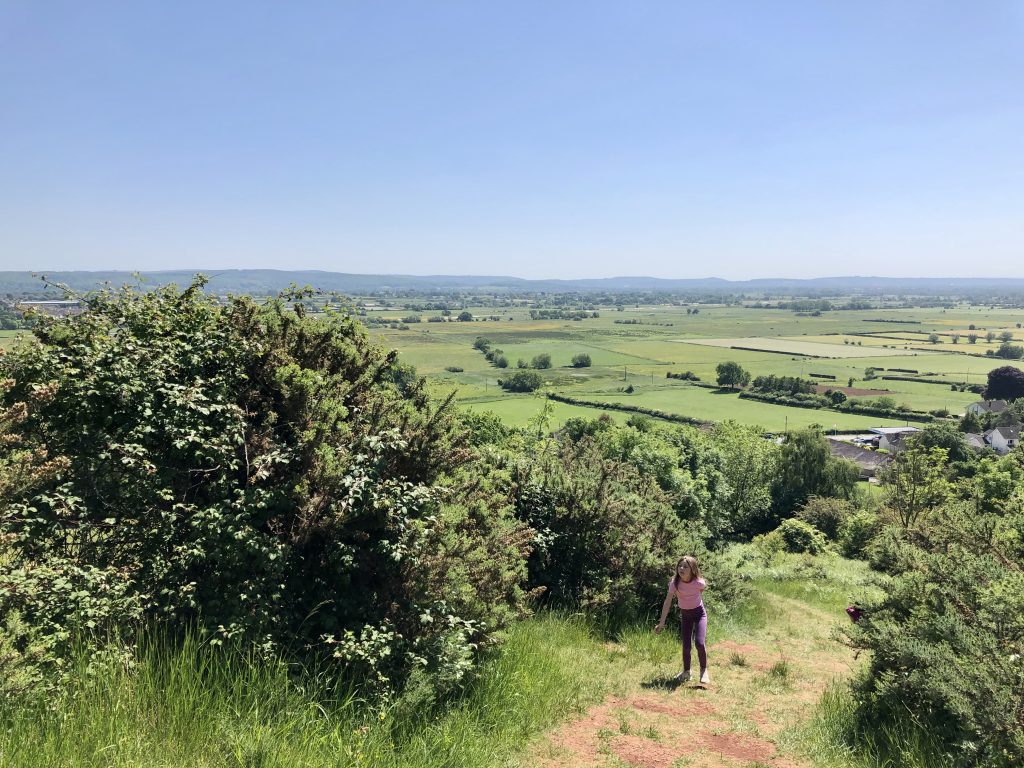
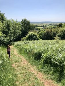
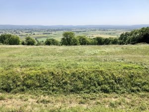
This walking route takes in far-reaching views over the Somerset Levels from the top of Cadbury Camp. Cadbury Camp is the site of an Iron Age Hillfort.
Walk Information:
Distance: 2.75 Miles (4.4 km)
OS Map: Landranger 172; Explorer 154
Elevation: 120 m
Dog Friendly: Yes (beware of live stock)
Start/Finish Grid Ref:
Accessibility: Not suitable for wheelchairs or pushchairs
Parking: Small roadside layby next to Tickenham Church, The Causeway, BS21 6SB
If there is no space here, or along the road near here, there is parking at Tickenham Village Hall, Clevedon Road, BS21 6RX.
What3Words: ///digits.pine.bumpy
How long does it take: Allow 1.5 – 2 hrs including stop for picnic or snacks.
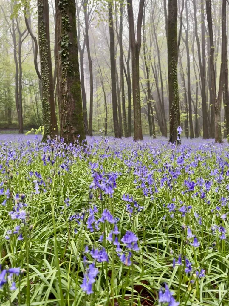
Points of Interest: Iron Age Hillfort, river for pooh sticks, wildflowers, great views!
Things to Note
After rain the paths can get very muddy leading up to the hillfort and can be slippery. Cattle graze the area during some of the year and they can make the paths muddy as well. The ground is really bumpy and uneven at the summit from the remains of the Hillfort. Keep dogs on a lead around grazing animals.

This walk can be combined with a pub lunch at The Old Inn, Clevedon (2.5 miles away).
About Cadbury Camp and Iron Age Hillfort.
Cadbury Camp is an Iron Age Hillfort which sits on a natural ridge overlooking the village of Tickenham in North Somerset. It sits between the North Somerset Levels and the Gordano Valley. A bronze spear or axe head was found at the site which shows the hill was being used in the Bronze Age (c.3300 BC to 1200 BC). This spear/axe head is now kept in the Museum of Somerset in Taunton.
Cadbury Camp was still occupied through the Roman era (AD 43 to AD 410), the sub-Roman period when the area became part of a Celtic kingdom.
The Iron Age hill fort was thought to have been constructed by the local Dobunni people and occupied from around the 6th-century BC to the mid-1st century AD. The ramparts are still visible consisting of massive grassy banks and ditches. The earth banks would have been topped with a wooden fence.
Pottery fragments, Roman coins and a statue were also discovered, which shows evidence of the site being occupied during the Roman era.
WWII
During the Second World War the camp was used as a searchlight battery to locate enemy aircraft, so they could be shot down before bombing Bristol.
National Trust
Cadbury Camp is now a scheduled ancient monument managed by the National Trust. The work the National Trust carry out includes removing bracken, non-native trees who’s roots are damaging the earthen banks, and maintain the woodland areas. Cows often graze the area which helps manage the grassland by encouraging more diversity of plants.
Nature Conservation Area
Cadbury Camp is an important nature conservation area with a variety of wildflowers, butterflies and other insects. We were covered with grasshoppers and crickets when we visited on a hot summers day.
Is Cadbury Camp worth visiting?
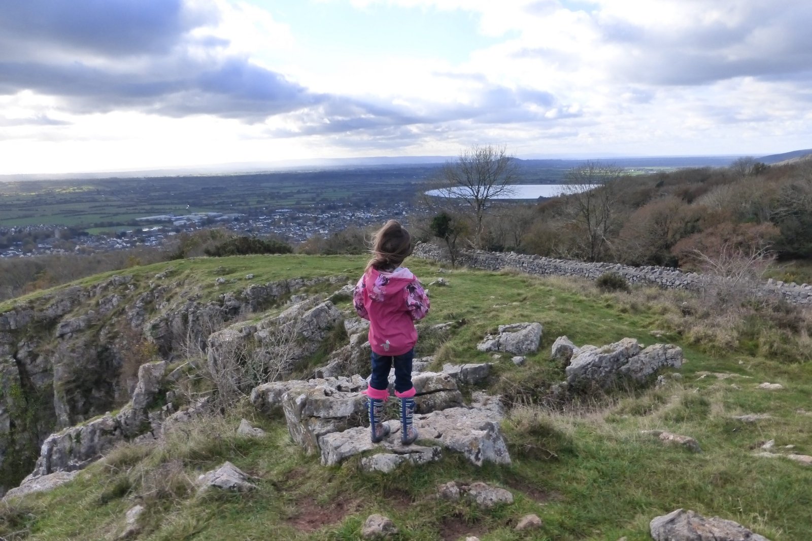
Cadbury Camp is definitely worth visiting. Not only is it a lovely walk, particularly on a warm summers day, but the views from the top over the Somerset Levels are spectacular. The area is mainly used by locals, walking or picnicking, making the most of the views and enjoying the wildlife, and dog-walkers.
This National Trust site is less well-known which means that it’s never crowded. We’ve often had the place to ourselves. Cadbury Camp is FREE to visit so what’s not to like?
How to Get to Cadbury Camp
By car: From M5 Jct 20 via B313o to Tickenham; From South Bristol via B3130 over Failand.
By Bus: Bus X6 and X7 from Bristol Bus station to Clevedon goes via Tickenham (alight near Village Hall).
Level of Difficulty
I would rate this Cadbury Camp walk as moderate, There is a steep uphill section to the top of Cadbury Camp, rocky uneven paths, gates, steps and stiles. Parts of the route can be muddy and slippery after rain.
Cadbury Camp Circular Walk Directions
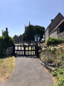
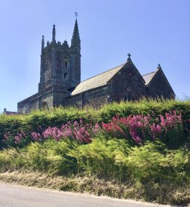
🥾 The walk starts from the layby next to Tickenham Church. (The church of St Quiricus and St Julietta dates back to the 11th Century).

🥾 With the church in front of you, turn right and follow the road steeply round to the left, passing the church gates on your left-hand side. The road is narrow here, so beware.
🥾 Walk along the road (Washing Pound Lane) for about 50 metres until you see a kissing gate on your left.
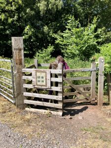
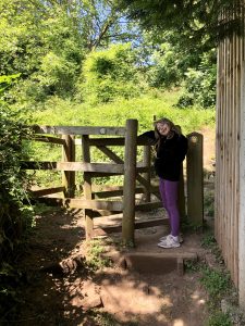
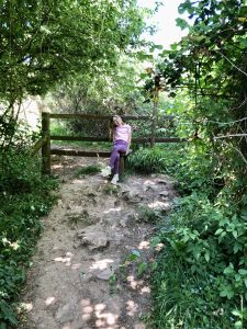
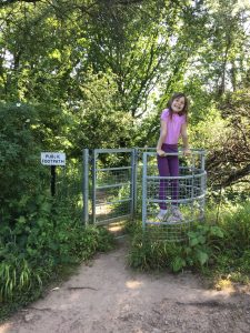
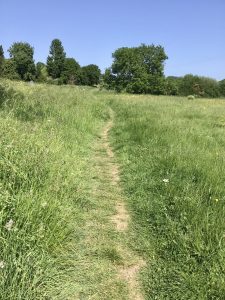
🥾 Go through the gate and follow a well-trodden footpath through the field. It takes you slightly uphill to a gate.

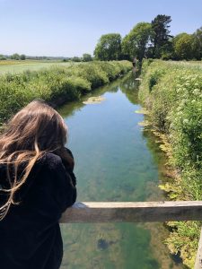
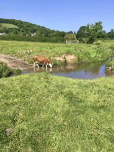
🥾 The gate leads you over a small bridge across the Land Yeo river. The water was really clear and we stopped for a quick game of pooh sticks and to try and spot some fish.

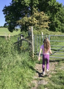
🥾 Go through another gate on the other side of the bridge and continue uphill along the footpath to the top of the field. Here, there is another gate which comes out at the side of the road (B3130).
🥾 Carefully cross the road to the footpath on the other side. There is no pavement on this side of the road so stand back. This road may be busy.

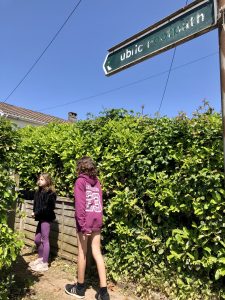
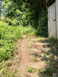
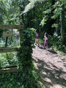
🥾 Turn left and walk along the pavement next to the road until you see a public footpath sign on your right-hand side (between houses 217 and 219). Go through the gate and continue up the footpath which runs between the gardens.

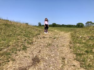
🥾 Go through a kissing gate and take the right-hand path, up some steps. The footpath become very steep. Turn around here for some great views across the North Somerset Levels.
Cadbury Camp
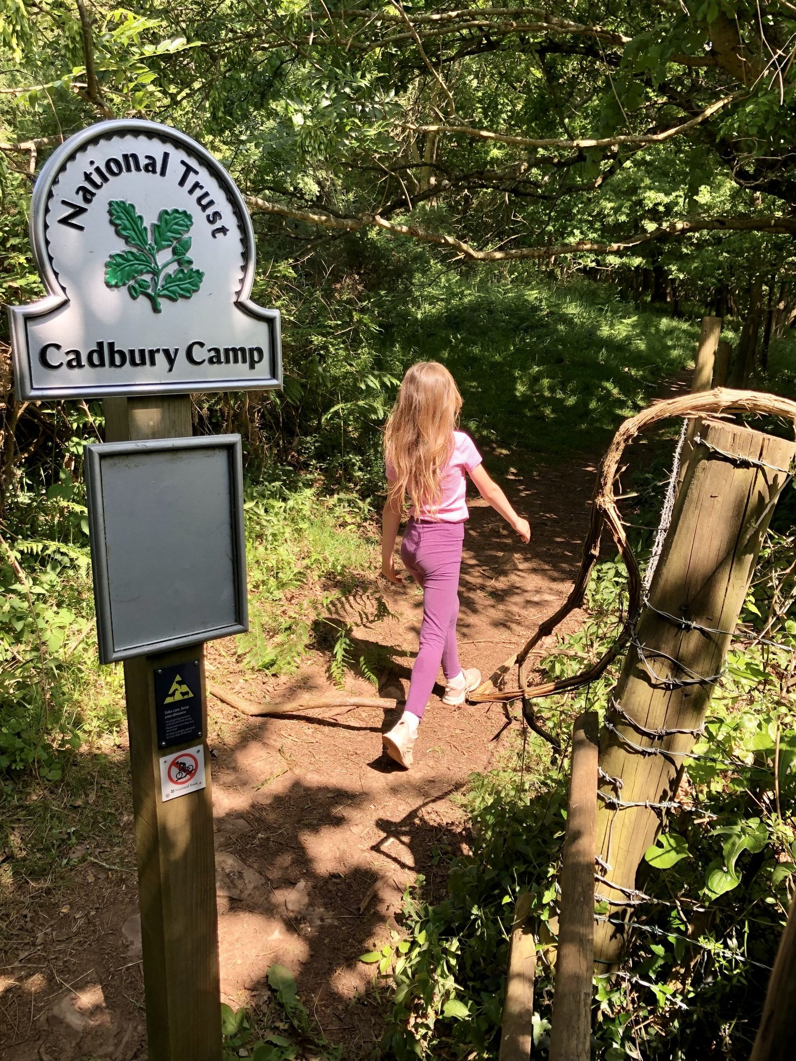
🥾 Climb over a stile where you’ll see a National Trust sign. Here, you can go left or right – either way brings you out on the top of Cadbury Camp.

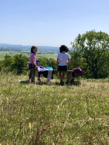
🥾 Spot the bench at the top of the hill – the perfect spot for refreshments with a view! Over towards the right you’ll see the Severn Estuary, Flat Holm, Steep Holm and Sand Point. Over towards the left are the Mendip Hills.


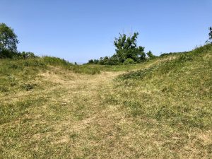
🥾 Continue on up the hill towards the ramparts of the Iron Age Hill Fort. You’ll see two ditches and two grassy banks. There are several paths that take you to the centre of the camp. Find gaps in the ramparts on the left or right and walk through the middle of the camp.

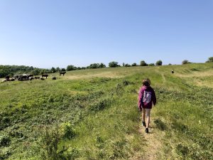
Cadbury Camp Hillfort is one of the most important Iron Age sites in the South-West. Cattle have been introduced to graze the rough grassland, and together with the removal of invading bracken and non-native trees, have increased the number of wildflowers and butterflies in the area and helped preserve the site. Dogs will need to be kept on a lead when the cattle are grazing in the summer months.
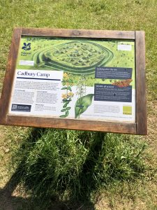
🥾 From the middle of the camp, head over towards the far left and exit the camp towards an information board. This will explain some of the history, give an artists impression of what the camp would have looked like, and explain how the site is now managed for wildlife and heritage.

Cadbury Camp Lane
🥾 Continue on the footpath, downhill to a gate. You are now leaving the National Trust site and on Cadbury Camp Lane.
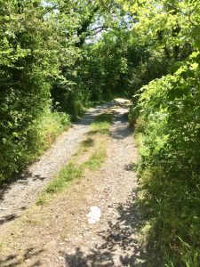
🥾 Turn left and follow the stony track alongside Cadbury Camp. The path is very rocky and uneven and eventually starts to go downhill.


🥾 At the bottom, you’ll see another gate on your left-hand side which takes you back onto Cadbury Camp. Don’t go through it, but continue on along Cadbury Camp Lane. This is a bridleway so you may see horse riders along here. You’ll see a bridleway sign pointing right but ignore this and continue on along Cadbury Camp Lane.
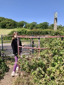
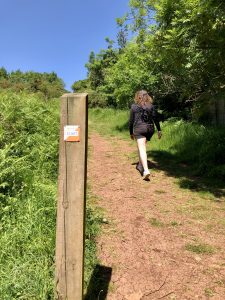
🥾 The track starts to go uphill and after a very short distance you’ll see a kissing gate on your left-hand side and a public footpath sign. Go through the gate and follow the footpath downhill. Please stay on the path.

🥾 The path splits into three a bit further down. Take the middle path which takes you steeply down hill. The path was very overgrown when we walked it in May, so long trousers may be advisable to protect yourself from ticks.
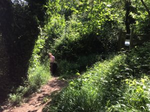
🥾 Further down, the path splits into two and you’ll see a post with public footpath signs. Take the left-hand path, downhill. The footpath runs alongside a field. Again, it was very over-grow when we walked the route. 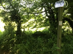

🥾 Continue on downhill until the footpath reaches a track and you’ll see some buildings and a garden. 
Tickenham
🥾 Turn right on the track and follow it downhill past a few houses to the main road (B3130). Cross over the main road to the pavement opposite and turn left. Then turn immediately right into Moor Lane.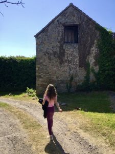
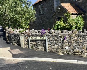
🥾 Continue down Moor Lane for about 200 metres, past some houses until you reach the Land Yeo river. Over the river on your left-hand side you’ll see a kissing gate. Go through the gate and walk through the fields, keeping the river immediately on your left. 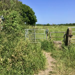
🥾 Go through another two pedestrian gates, walking alongside the river. This path through the farmers fields is a public right of way through privately owned land so please keep to the path. 
 🥾 Walk towards some trees and just before you reach a telegraph pole, the path comes to a cross-roads (if it’s over-grown this may not be very obvious). Look right and you should see a gate at the bottom of the field. Turn right here and head towards it.

🥾 Go through the pedestrian gate (next to a larger gate) and over a concrete area. Follow the path downhill to the left towards another gate and a line of trees. 
🥾 Go through this gate, marked with a yellow footpath arrow, and follow the tree line round to the left, keeping to the edge of the field. Round the corner you’ll see another metal gate leading out the field and onto a road (The Causeway). 
🥾 Turn left on the road towards the church. Follow the road round to the right (in front of the church) and back to the car.
For another Cadbury Camp Walk from Clapton in Gordano click here.
Facilities at Cadbury Camp
Cadbury Camp has no facilities, the nearest village is Tickenham which has a pub (The Star Inn).
What to wear and bring with you
I recommend wearing a good pair of walking boots/shoes to provide support and comfort because parts of this route are rocky and uneven. As I mentioned, the ground can get muddy and slippery after rain too.
I always recommend taking plenty of water with you to keep hydrated and it’s a nice spot for a picnic at the top (if weather permits). If, like us, you are walking with children, snacks/food are essential!
Always follow the Leave No Trace principle and take all your rubbish home with you. Leave only footprints!
Other things to do around Cadbury Camp
Clevedon
Discover Clevedon, a Victorian seaside town with England’s only Grade I listed pier (built in 1869). Explore Salthouse Fields and play park, Marine Lake, and Clevedon Court (NT). Read our post – Things to do in Clevedon.
Portishead
Explore Portishead: Walk around the marina, along the coast path to the lighthouse, or around the lake grounds.
Weston super Mare
Take a trip to the seaside in Weston super Mare: visit the huge sandy beach and The Grand Pier.
Tyntesfield
Visit Tyntesfield House and Estate, a National Trust property in Wraxall.
Ashton Court
Explore Ashton Court Estate on the outskirts of Bristol, home to Bristol Balloon Fiesta (August).
Bristol
Head into the city of Bristol, explore the waterfront, SS Great Britain, shops, markets and museums. Discover the famous street art, and walk across Clifton Suspension Bridge. Read our post – Things to do in Bristol with kids: family attractions and days out.
Puxton Park
Visit Puxton Park for a family fun day out. Kids will love the Adventure Park with Adventure Area, Animal Zone, Indoor Soft Play, Water Rides, and Mini Railway.